Log in
All resources
Create a design
452 Free Artworks of 1860 Maps
gemeente atlas van nederland - north holland
1860s maps of north holland
gemeente atlas van nederland - south holland
1860s maps of south holland
nieuwkoop in the 19th century
media from regionaal archief alkmaar
19th-century maps of rotterdam
hoeksche waard in the 19th century
old maps of haarlem
goeree-overflakkee in the 19th century
cornell's primary geography (1860)
1867 maps of africa
gemeente atlas van nederland - south holland
maps of waddinxveen
gemeente atlas van nederland - south holland
giessen (river south-holland)
maps of nieuw-helvoet
nieuw-helvoet
gemeente atlas van nederland - groningen
maps of appingedam
gemeente atlas van nederland - north holland
old maps of alkmaar
gemeente atlas van nederland - south holland
1860s maps of south holland
media from regionaal archief alkmaar
old maps of schagen
gemeente atlas van nederland - south holland
maps of zoeterwoude
maps by takeshiro matsuura
old maps of ezo
gemeente atlas van nederland - south holland
19th-century maps of rotterdam
gemeente atlas van nederland - south holland
19th-century maps of rotterdam
gemeente atlas van nederland - south holland
old maps of gouda
gemeente atlas van nederland - south holland
1860s maps of south holland
gemeente atlas van nederland - south holland
1860s maps of south holland
gemeente atlas van nederland - south holland
1860s maps of south holland
gemeente atlas van nederland - south holland
1860s maps of south holland
gemeente atlas van nederland - south holland
1860s maps of south holland
gemeente atlas van nederland - south holland
old maps of gouda
cornell's primary geography (1860)
1867 maps of asia
gemeente atlas van nederland - south holland
old maps of leiden
gemeente atlas van nederland - south holland
1860s maps of south holland
gemeente atlas van nederland - south holland
1860s maps of south holland
gemeente atlas van nederland - south holland
maps of piershil
gemeente atlas van nederland - south holland
maps of goudswaard
gemeente atlas van nederland - south holland
1860s maps of south holland
maps in the rijksmuseum amsterdam
published by frans buffa & zonen
gemeente atlas van nederland - south holland
maps of wassenaar
gemeente atlas van nederland - south holland
1860s maps of south holland
gemeente atlas van nederland - south holland
1860s maps of south holland
gemeente atlas van nederland - north holland
maps of texel
gemeente atlas van nederland - south holland
1860s maps of south holland
gemeente atlas van nederland - north holland
old maps of haarlem
gemeente atlas van nederland - north holland
maps of bloemendaal
gemeente atlas van nederland - south holland
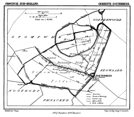
maps of zoetermeer
gemeente atlas van nederland - south holland
1860s maps of south holland
media from regionaal archief alkmaar
oudkarspel
gemeente atlas van nederland - north holland
maps of muiden
gemeente atlas van nederland - south holland
1860s maps of south holland
gemeente atlas van nederland - south holland
1860s maps of south holland
gemeente atlas van nederland - south holland
maps of kedichem
gemeente atlas van nederland - north holland
maps of uithoorn
gemeente atlas van nederland - north holland
maps of zandvoort
gemeente atlas van nederland - north holland
blokker
gemeente atlas van nederland - south holland
maps of zuid-beijerland
media from regionaal archief alkmaar
maps of barsingerhorn
gemeente atlas van nederland - south holland
1860s maps of south holland
gemeente atlas van nederland - south holland
old maps of delft
gemeente atlas van nederland - north holland
old maps of haarlem
gemeente atlas van nederland - south holland
maps of spijkenisse
chicago and the midwest, newberry library
globes by rand mcnally
1860s maps of china
1863 maps of asia
gemeente atlas van nederland - south holland
1860s maps of south holland
gemeente atlas van nederland - south holland
1860s maps of south holland
gemeente atlas van nederland - north holland
old maps of alkmaar
gemeente atlas van nederland - south holland
1860s maps of south holland
gemeente atlas van nederland - north holland
old maps of haarlem
gemeente atlas van nederland - north holland
maps of landsmeer
gemeente atlas van nederland - north holland
maps of spanbroek
gemeente atlas van nederland - north holland
maps of avenhorn
gemeente atlas van nederland - north holland
maps of schellinkhout
gemeente atlas van nederland - north holland
maps of krommenie
gemeente atlas van nederland - north holland
maps of oudendijk
gemeente atlas van nederland - north holland
maps of wieringerwaard
gemeente atlas van nederland - north holland
maps of hensbroek
gemeente atlas van nederland - north holland
maps of katwoude
gemeente atlas van nederland - north holland
maps of wognum
gemeente atlas van nederland - north holland
maps of zwaag
gemeente atlas van nederland - north holland
maps of wijdenes
gemeente atlas van nederland - north holland
maps of hoogkarspel
gemeente atlas van nederland - north holland
maps of ursem
gemeente atlas van nederland - north holland
maps of obdam
gemeente atlas van nederland - north holland
maps of sijbekarspel
gemeente atlas van nederland - north holland
maps of berkhout
gemeente atlas van nederland - south holland
1860s maps of south holland
gemeente atlas van nederland - north holland
old maps of heemstede, north holland
gemeente atlas van nederland - south holland
1860s maps of south holland
gemeente atlas van nederland - south holland
maps of zegwaart
gemeente atlas van nederland - south holland
1860s maps of south holland
gemeente atlas van nederland - north holland
maps of wijdewormer
gemeente atlas van nederland - north holland
maps of westzaan
gemeente atlas van nederland - north holland
maps of urk
gemeente atlas van nederland - north holland
maps of midwoud
gemeente atlas van nederland - north holland
maps of vlieland
gemeente atlas van nederland - north holland
maps of twisk
gemeente atlas van nederland - north holland
maps of westwoud
gemeente atlas van nederland - north holland
maps of ilpendam
gemeente atlas van nederland - north holland
maps of opmeer
gemeente atlas van nederland - north holland
maps of middelie
gemeente atlas van nederland - north holland
maps of bovenkarspel
gemeente atlas van nederland - north holland
maps of wormer
gemeente atlas van nederland - north holland
maps of opperdoes
gemeente atlas van nederland - north holland
maps of hoogwoud
gemeente atlas van nederland - north holland
maps of warder
gemeente atlas van nederland - north holland
maps of wormerveer
gemeente atlas van nederland - north holland
maps of uitgeest
gemeente atlas van nederland - north holland
maps of oosthuizen
gemeente atlas van nederland - south holland
1860s maps of south holland
gemeente atlas van nederland - south holland
1860s maps of south holland
gemeente atlas van nederland - overijssel
netherlands in the 1860s
201 - 300 of 452
Next page
/ 5